A Tale of Two Langleys: Township of Langley and the City of Langley
With the population growing constantly, newcomers to Fraser Valley soon learn that “Langley” is more complicated than it seems. What outsiders often refer to as one general area includes two distinct municipalities that go way back, and are the setting of some of BC’s earliest settlement stories. The tale of how there came to be two Langleys — the Township of Langley and the City of Langley — is a story about a culture clash and a changing world.
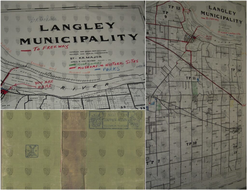
The Langley Boundaries: The Survey Says?
People learn quickly that the Township of Langley is bigger than the City of Langley, but did you know the Township covers 31 times more land than the city? The Township boasts a land mass of 316 square kilometres versus the dense 10-square-kilometre City of Langley on its western edge.
The Township extends from the American border north to the Fraser River and stretches from 196th Street in the west to 276th Street in the east. Population-wise, the two municipalities are much closer, with the Township having only 5 times as many people as Langley City. But that’s because the Township still thrives on farming, with 75% of the Township sitting within the Agricultural Land Reserve, home to half of Metro Vancouver’s farmland.
The City’s boundaries are not so straight-forward as the Township’s, but both Langleys were mapped out through land surveys. The municipalities were devised through landmarks and natural features, much in the same way private property boundaries are established.
Before the Great Divide in Langley
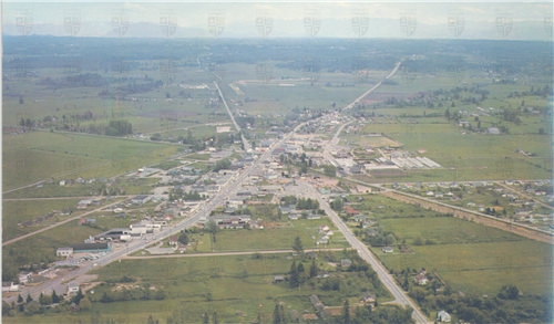
Folks in Vancouver and other larger cities may not consider the 30,000 or so people living in the City of Langley to be metropolitan, but things were different back in the day. A century ago, what’s now the City was already bustling with shops, residences, schools, and everything else you’d find in a growing urban centre. Meanwhile, the rest of the Township was bucolic and vast, what was once known as the Langley Prairie. The development you see in the Township today was still decades away for the hotbed of farming.
Life was changing. The automobile was redefining everything — roads required paving, streets needed signage and parking. But electricity and modern plumbing were also growing in demand in the city. The farm-filled Langley Prairie had little traffic and no need to pave things. Plumbing and other infrastructure was still too costly for them to benefit from. In the Prairie’s busy urban center, modern amenities were needed to keep driving business and growth.
Like most areas where rural and urban crowds are pitted against each other, the farmers and others on the agricultural part of the Prairie felt overtaxed, paying for amenities they couldn’t benefit from.
And Then There Were Two Langleys
Over the next couple decades, as cars multiplied and modernity transformed the business district, Langley’s squabbles grew, as squabbles often do.
As historian Warren Sommer retold in his book Nothing Without Effort: A History of Langley, the evolution of the Langleys was akin to a family feud — bickering between neighbours in the city and the country.
The bickering started in 1922 and escalated into the 1930s — a time during which car ownership made the leap from the upper class to becoming common. Car ownership in America tripled in the 1920s alone and was a major driver in a push for roads and car-related infrastructure.
But the urban centre needed all kinds of expensive infrastructure. Langley’s list was long for running water, electric streetlights, and sewage in the City.
According to Sommer, things settled down during the Second World War, but with the cessation of hostilities abroad, things soon heated up in the Valley. Farmers repeatedly voted against using general revenue to cover any urban needs, stoking resentments on both sides.
It all bubbled to a head in the early ‘50s, and in 1955, a referendum changed everything — voters chose to separate the City of Langley from the Township of Langley, forming a new municipality. The City of Langley was incorporated on March 15, 1955.
Through it all, Isaak, Osman & Associates has been a part of Langley’s growth. We’ve been establishing boundaries and making surveys in Langley and the Fraser Valley since 1946.
If your area has had a lot of development and you haven’t had a survey recently, it may be time to give us a call to ensure your investment is protected.
Sources: Langley Then and Now: 1949 vote start of split between Township and City – Aldergrove Star, Family feud, Langley style – Today In BC, The South Fraser Blog: The “A” Word – Amalgamation in Langley (nathanpachal.com), The Age of the Automobile [ushistory.org], Township of Langley | Lower Mainland Local Government Association (lmlga.ca), About the Township (tol.ca), Learn about Langley City | City of Langley